Services
Our comprehensive services include architectural design, structural and building inspections, aerial photography and videography, environmental inspection and mapping, utility pole inspections, and drone security services. We strive to deliver top-notch solutions to meet your unique needs.
-

Mapping
Get accurate and high-resolution maps with Drone Orthomosaic Mapping. Our technology uses drone photography to produce detailed geo-referenced maps for surveying, farming, building, and environmental monitoring. Contact us for precision measurements and analysis.
-

Inspection
Using drones to acquire geospatial data can streamline your project. Our solution provides accurate and detailed data, enabling the detection of anomalies and precise visualizations. In addition, our drone inspections are perfect for hard-to-reach areas since they give valuable data for early project scoping and ongoing project management.
-

Project Management
RadFlight provides drone consulting and project management services to help businesses navigate the evolving drone technology landscape and ensure safety and accuracy with our qualified, vetted pilots. Contact us today to learn more about how drones can improve their business.
-

Training
Are you looking to become a top-level drone pilot? Look no further than RadFlight Academy. Master Instructor Tim Baur created our in-house materials. Tim, who has 22 years of experience, will teach you everything you need. We cover it all, from tower surveying to building inspection to GIS. Plus, we'll teach you how to use the latest technologies like photogrammetry and thermal sensors to get the needed data. So, join the hundreds of students trained with us and take your drone skills to new heights.
-

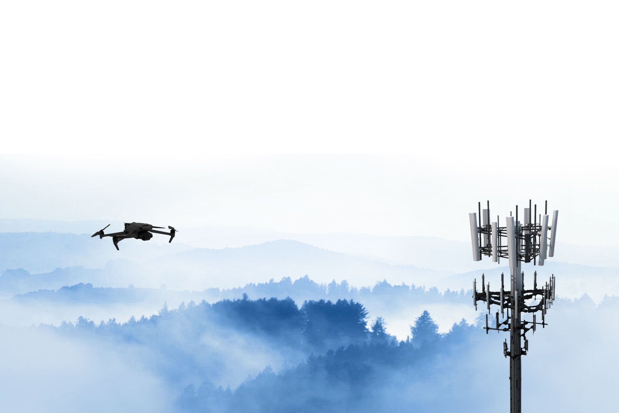
Telecommunications
Drones can inspect every part of a tower from the air and at various angles. Inspectors can then view the broadcast from the ground using a tablet, lowering the possibility of accidents and fatalities.
-

Environmental
Drones are unequaled for keeping tabs on nature. They produce high-resolution images of ecosystems, track endangered species with heat sensors, monitor water and air pollution, and even help with disaster response. They give scientists and conservationists a new way to gather data and keep our planet healthy.

Mapping / Environmental
Drone Orthomosaic mapping involves flying a drone over a given area and obtaining several overlapping photos to produce high-resolution, geo-referenced maps. An Orthomosaic is a single, continuous map made from the combination of several images, which enables accurate mapping of vast areas and allows for precise measurements. It can be applied to various tasks, including surveying, farming, building, and environmental monitoring.
Projects:

Inspection
Drone Orthomosaic mapping involves flying a drone over a given area and obtaining several overlapping photos to produce high-resolution, geo-referenced maps. An Orthomosaic, is a single, continuous map made from the combination of several photos, enables accurate mapping of vast areas and allows for precise measurements. It can be applied to a variety of tasks, including surveying, farming, building, and environmental monitoring.
Projects: Cooper Arms

Training
Looking to become a top-level drone pilot? Look no further than RadFlight Academy! Our in-house materials, created by Master Instructor Tim Baur (who's got 22 years of experience under his belt), will teach you everything you need to know. We cover it all, from tower surveying to building inspection to GIS. Plus, we'll teach you how to use cool tech like photogrammetry and thermal sensors to get the data you need. Join the hundreds of students who've trained with us and take your drone skills to new heights!